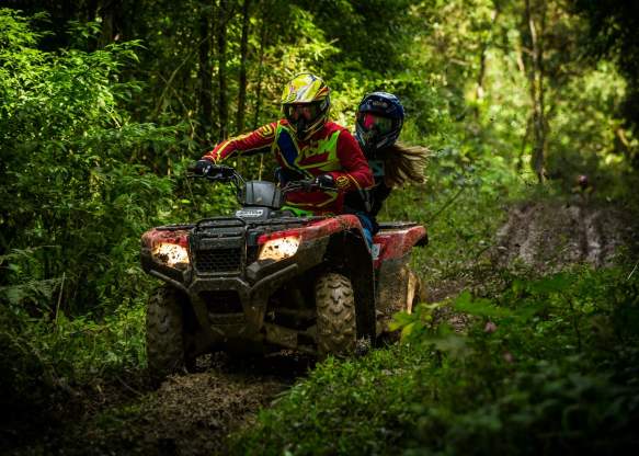
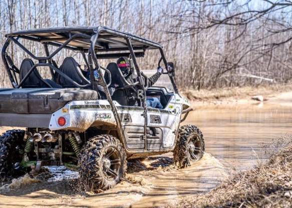
ORV and ATV in Grayling
Frederic ORV Trail
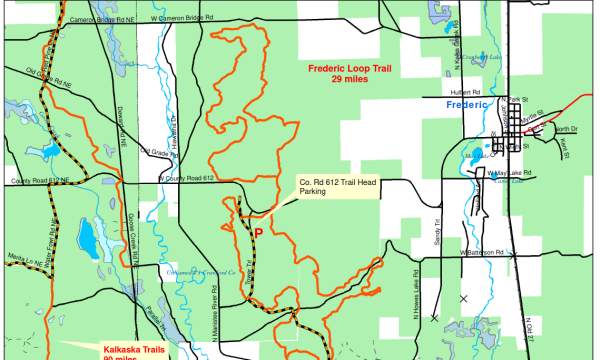
There are miles and miles of the Frederic ORV Route available for all sizes of ORV's. The Frederic Trail runs from the trail head off M-72 and heads north to the trail head off County Road 6-12. The…
FENNCO
Providing fun in our area! Come enjoy the trails and lakes in Northern Michigan in style and comfort in one of our Polaris RZR 1000’s, Pontoon boats or snowmobiles. Bring the family and enjoy a day…
-
So where can I ride my ORV in Grayling MI??
The Bottom Line for Crawford County Roads:
So what does the ORV ordinance mean to the average rider in Crawford County? Get a map and make sure you know where the designated trails and roads are for ORV/ATV riders. The ordinance that allows riding on the shoulders of most of the county-maintained roads in our county does NOT address riding on state trail roads or state property.
What is a county road? Make sure you have a good map that shows what a county road is and what a logging trail or two-track is. Carry a GPS or compass so you don’t get lost.
You are allowed to ride only on the shoulders of some of the roads in Crawford County; there are 5 townships and they all have designated roads on the map. Each township has the authority to open or close any of the county-maintained roads in their township. State (M-roads) are NOT open at any point. Private driveways and private subdivisions are also NOT open unless they are maintained by the county.
There are a few areas/roads which may be closed from time to time due to military activity. Please do not drive around any barricades that you might come across! This could pose a danger to you and to the military training!
City of Grayling ORV Ordinance: Ord #2010-01 ORV Ordinance city 2017
-
It’s the Law—Land Use Rules on State or National Forest lands
ORV Operation on State-Owned Lands
In order to use these state forest areas you must have a “Michigan Recreation Passport”. Those are available to purchase at state parks, when renewing Michigan car registrations or when a state ranger is at the site. If there is no ranger when you arrive, they may put an envelope on your car and request that you purchase one by mail.
Lower Peninsula: ORV operation is permitted on all designated trails, designated areas, and designated routes unless they are posted closed. Northern Lower Peninsula maps: 6,308.6 miles (84%) of roads are open and 1,213.6 (16%) miles are closed.
Statewide: ORV use on designated trails is limited to vehicles 50 inches or less in width. Off-trail or off-route operation outside of a designated area is prohibited except for licensed hunters operating an ORV at speeds of 5 mph or less for the purpose of removing deer, bear, or elk.
ORV Operation on National Forest Lands
In all national forests, motor vehicles can be used only on roads, trails, or areas that are designated as open. This includes all motorized wheeled vehicles from ATVs to street-legal vehicles.
-
ORV use around Camp Grayling training areas and ranges
Following the Department of Natural Resources’ initial inventory and mapping of all state forest roads in Michigan to determine which roads would be open to off-road vehicle use – a process that took roughly two years and was completed at the end of 2018 – the DNR and the Camp Grayling Joint Maneuver Training Center are providing clarification about state forest roads and snowmobile trails within Camp Grayling training areas and ranges.
All unmarked or unnamed state forest roads and trails in designated Camp Grayling training areas are off-limits to ORV use. The DNR’s interactive map showing current road status is available on the DNR webpage Michigan.gov/ForestRoads. Printable Crawford County and Camp Grayling forest roads maps are available, too.
When Public Act 288 (the legislation outlining the mapping and inventory process) was enacted in 2016, lands within the Camp Grayling training areas were not open to ORV use. Trails and roads in Camp Grayling always have been off-limits to ORV traffic.
“To ensure the safety of ORV users and to minimize potential conflicts with military training efforts, it was determined that roads on Camp Grayling lands would remain closed to ORV use,” said Sgt. 1st Class Jeremie Mead, community relations specialist for Camp Grayling. “Signs have been posted on the perimeter of the Camp Grayling lands, to clearly alert the public that these roads and trails are closed.”
For safety and security purposes, Camp Grayling officials and DNR conservation officers will monitor these restricted areas. Anyone operating an ORV within a restricted area that has been closed to such use by order of the DNR director is responsible for a state civil infraction and may be ordered to pay a civil fine of up to $500.
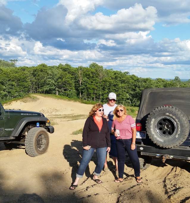
In some cases, the DNR will issue “event use permits” for registered conventional vehicles, such as a Jeep, for use of state-managed land. For more information about specific requirements or to apply for a permit, please visit the Public Land section of the DNR website under Managing Your Resources.
Camp Grayling’s Multi-Purpose Range Complex (aka the Range 30 Complex) and the Air to Ground Range (aka the Range 40 Complex) have times when, for safety reasons, named roads in the area also are closed to all civilian traffic. Reference Camp Grayling’s Facebook page to see weekly range firing announcements and closure updates.
DNR Deputy Director Bill O’Neill said the department appreciates the public’s cooperation in observing the closed or open status of state forest roads and trails.
“Our state forest roads are a terrific resource in allowing people to get outside and enjoy Michigan’s public forests, and a lot of work went into understanding the conditions and availability of thousands of miles of these roads,” O’Neill said. “Nearly 12,000 miles of state forest roads are open year-round to off-road vehicle use. So, in cases like at Camp Grayling, where there are good reasons for closure, it’s important for everyone to honor the rules.”
When traveling near or around Camp Grayling, respect all closed gates. If you drive up to a closed gate and feel that the gate is mistakenly closed, or have any other questions, call Camp Grayling Headquarters at 989-344-6100.
-
ORV ETHICS
- Share the trails.
- Have respect for other users. Slow down or stop your ORV when you approach others on the trail.
- When meeting equestrians, approach slowly, pull over and stop, turn off your engine.
- “Leave no Trace”. Trash is an eyesore; even biodegradable materials, such as food scraps, take time to break down. If you “Pack it In, Pack it Out”.
- Respect the rights of others on trails.
- Respect seasonal closures and adhere to Military closures.
- Respect wet areas and waterways. They are a vital resource for many plants and animals.
- Remember, taking shortcuts damages trails and causes erosion.
- Riding off trail can destroy animal burrows and spread harmful weeds that damage habitats and kill native plants.
- State and Federal trail roads are not open to ORV use unless signed and designated as open with the exception of ORV Certification for persons with a disability.
People with Disabilities
Persons that meet a certain criteria are permitted to operate licensed ATVs/ORVs less than 50″ wide on forest roads that are open to public vehicular travel on state lands (including those not posted open to ORVs). Privileges do not extend to cross-country travel nor to areas, trails and roads specifically posted CLOSED to vehicle or ORV use, nor to the operation of an ORV within state game, wildlife, or research areas, federal forest lands, state parks, state recreation areas or trailways.
-
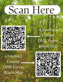 DNR Mi. Offroad Vehicle Handbook
Crawford County Maps – divided by townships
Crawford County DNR ORV 2019 24×24 – this map has open shoulders and open DNR trails
18×24 Map from the DNR – this map doesn’t have open county roads marked
This is the Crawford County DNR Map Printable cut into sections that you can print on your home computer and tape together if you are looking to ride your ORV in Grayling MI.
This seems like a great option – Download Avenza to your smartphone from the Google Playstore: The Avenza Maps® app uses your device’s built-in GPS to locate you even when you are out of range of a network or internet connection. Download the DNR map to your phone and open it into the Avenza map.
Maps used in the app are geospatial PDFs, GeoPDF or GeoTIFFs. You can import your own, or find just the right one in the Avenza Map Store. Note – some of these cost money so check before you download.
Use the mapping tools in the app to add GPS tracks, add placemarks, add photos and more.
Avenza Maps is free for recreational use. If you need it for work, you’ll need an Avenza Maps Pro Subscription
With an ORV Ordinance in Crawford County that opens the shoulders of some county roads to ORV traffic, a connected trail system is available that leads into Kalkaska County. The Frederic Loop ORV Trail is 29 miles long and open to ORV’s less than 50 inches in width. This typically accommodates ATVs and motorcycles. Taking Cameron Bridge Road according to the ordinance, the Frederic Trail system connects into the Kalkaska system with over 100 miles available.
There are also 9 miles of the Frederic ORV Route available for all sizes of ORV’s. The Frederic Trail runs from the trail head off M-72 and heads north to the trail head off County Road 6-12. The trail north of 6-12 and south of Cameron Bridge Road is an ORV trail which is open to ATVs (i.e; 3-wheelers, 4-wheelers, motorcycles.) Note, use of any of these trails requires an ORV sticker.
The only “Cycle” trail (single track trail) located in Crawford County is the MCCCT trail located in Beaver Creek Township.
This ordinance, refers only to the shoulders of some county roads, and is not applicable to state roads or state land and state-owned two tracks. With the passage of PA288, some of the roads and property maintained by the Department of Natural Resources are open to ORV traffic; open unless posted closed. Most campgrounds also do not allow ORV traffic. Please be sure to read the ordinance and get a county map outlining where you can ride. Always give motor-vehicle traffic the right of way, and avoid close contact with horses. There are several locations where horse and ORV traffic share the same trail. Please slow down and stay as far away from the horses as possible.
There are also several areas in Crawford County that are operated by the Michigan National Guard and are posted off-limits. Most are fenced or gated. ORV traffic may not access gated areas for safety reasons. (details below)
-
Download the Frederic ORV Trail and ORV Route Map
